We hopped out of bed at 6am and hit the road before 6:30 AM, temporarily energized by a very full night of sleep. We weren’t certain of our final destination for the day, but we probably wouldn’t go any further than Grangeville at 135 miles. We were still holding firm on our plan to take it easy a few days and give my knees a rest. If I had the opportunity to fix one problem at least, I knew that I probably should take it.
The temperature hovered in the high 30s at first, but it looked like it would turn into a beautiful day. After passing just a couple of small streets we left the tiny town of Cambridge and joined a highway, enjoying the first rays of bright sunshine.
I couldn’t work up any speed this morning because my knees hurt more than yesterday, and I watched Chris’s frustration grow. We settled into a routine of separating and then reuniting every few miles after he stopped to wait for me yet again. I’d look at my GPS and wonder how we had managed to gain so little ground. And was something wrong with my perception of time? We originally planned to stop for food about 10 miles in, but I was a little stressed about how high the sun was in the sky. The energy from our full night of sleep wore off within the first hour, and I just could not get myself motivated.
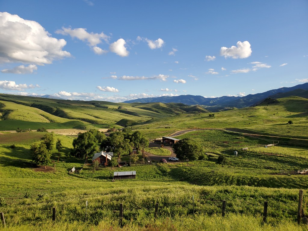
During one of Chris’s many stop-and-waits along the side of the road, he double checked our services spreadsheet and found the 7 Devils Diner in Council. Choosing to aim for Council would give us an extra hour on the road, which helped me feel a tiny bit better. We continued plodding along, and at some point passed a large barn blasting country music very loudly. Was someone having a hoedown at 7am? The mostly treeless land spread out around us for miles, and a mountain loomed straight ahead. I wondered if we’d ride over it later this morning.
Mark passed us one last time just outside of Council, and asked me if my knees were feeling better. It turns out he would end up scratching a few days later due to his own joint issues. Today, however, he passed us with ease. Great, we were now behind the guy who was aiming to finish in 40 days. I had no idea what we were aiming for anymore, and it only served to contribute to my lethargy for the day. If I were healthier, we could do this in 25 or 30 days for sure. If, if, if. Whine, whine, whine.
As the highway took a big left curve, we finally hit the little town of Council. We wound our way through a few sleepy downtown streets until we found the diner. The morning was still absolutely gorgeous, but I nonetheless felt a little creeped out by how dead the town seemed. We walked into the quiet diner, dotted with just a few patrons who looked like they probably ate there every morning. Our waitress sat us in the corner by the door, as far away from the regulars as possible. I felt their confused stares as I walked back to the bathroom.
Upon returning I ordered a big stack of pancakes and settled in to ice my knees while I did a little google searching about seat position. I wanted to move mine further up and back, but Chris was hesitant to mess with the fit that I had dialed in so precisely in the year prior. We sipped our sad decaf coffees and I tried to pretend it was giving me an energy boost.
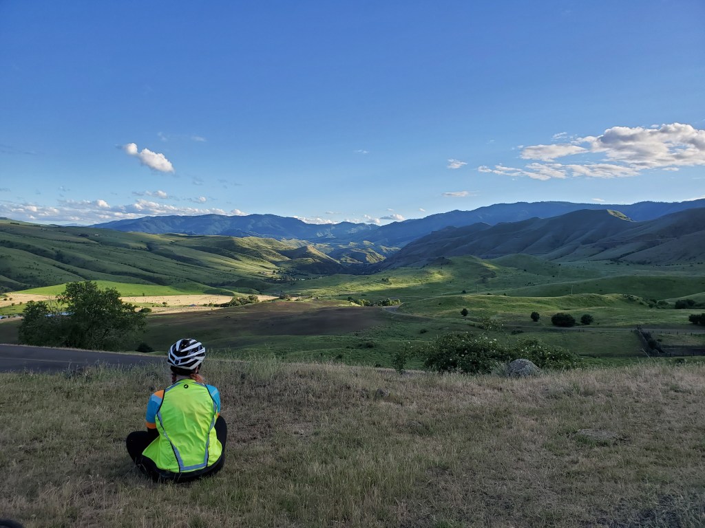
We didn’t linger for long, knowing we’d have to stop several times up the road to mess with my seat position. The road started climbing upwards just out of town, and about halfway up I shouted to Chris. I simply could not continue until we shifted my seat back, I decided. I could not stand my slow riding any longer, and I knew Chris was also operating at the edge of sanity. We pulled into a small dirt turnout and moved my seat up and back a couple times, while I rode in circles to test it in between. Afterwards, we took a second to look back down the road at the valley we had just passed through this morning. Traveling along the TransAmerica Trail certainly gave me a new appreciation for the vastness of the American West. Then we moved on and I instantly felt better! I could suddenly engage my hamstrings and calves more, which led to a burst of energy and speed. Pedaling no longer involved any pain whatsoever. If only I had decided to move my seat two days prior, instead of doubting myself!

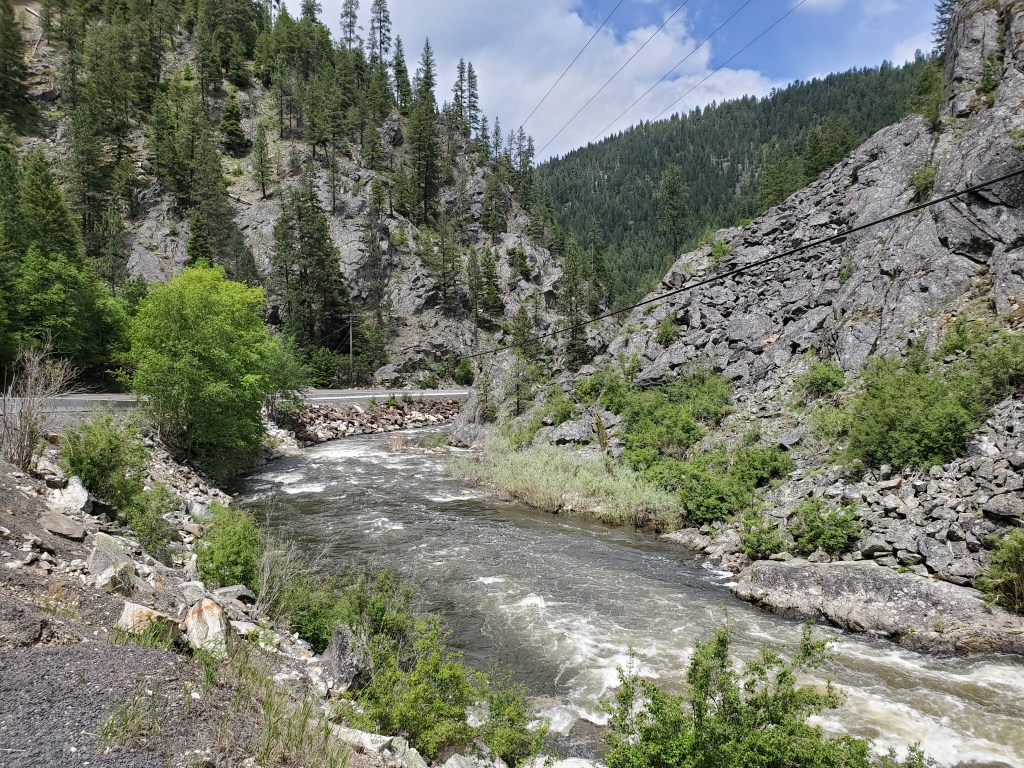
We flew through rolling mountainous territory for an hour or two. The two lane road wove around thick clumps of trees, with a cliff leading down to a roaring river on our right side. We hit a few sections of construction where the road narrowed to one lane and we had to wait at a stop light for our turn to dash through. Just after that, we came across the Huckleberry Cafe.
Feeling full from breakfast, we had no need for anything. However, Chris suddenly became overwhelmed by the urge to eat huckleberries. Oh well, might as well continue dragging our feet today!
We chatted with 5 or 6 people while we stopped at the cafe and played with Gato, the friendliest cat ever. The owner of the cafe walked around with a handgun on his hip, a notable departure from the city culture we were accustomed to. When we told him how much we wanted his cat, he said “I’m not much of a cat person, but if you tried to take her you’d have a fight on your hands”. [Chris: If only he hadn’t been armed…]

We signed their TransAmerica trail tourist book, and then I flipped through and read a couple inspiring messages from former TABR racers. I ordered an ice cream, and Chris decided on some huckleberry cheesecake. We even took the luxury of sitting down at one of their patio tables…I don’t know what got into us. 🙂 I was thankful for the chance to chat and enjoy local culture, but I knew we couldn’t stay for long because while we were eating storm clouds rolled in overhead. We ate quickly, and then began layering up to deal with the sudden chilly wind.
Right before we hopped on our bikes, Nathan and Anthony pulled into the parking lot to chat. They warned us how busy it would be in Grangeville due to weekend tourist traffic, and that we needed to reserve a room early if we wanted one. Just one problem – we’d had pretty sporadic cell service the last couple days. I remembered seeing a Facebook post the day prior from fellow racer Josh, who had managed to book the last room in the Super 8 and talked about nearly becoming hypothermic coming off of White Bird pass. If these storm clouds stuck around, we’d need to be careful today. Keep in mind, we just shipped our camping gear home two days ago and committed to sleeping in motels the rest of the trip.
Nathan said they were heading back to Portland for the remainder of the race, so we exchanged our final goodbyes and hit the road. Just around the corner from the shop a hailstorm randomly developed, so we had to stop on the side of the road to throw on our jackets. That was the pattern the rest of the day – boil in our jackets, then hail, boil, rain, boil, hail.

After flying down a descent and exiting the thick forest, we reached the town of New Meadows. Someone was waving at us, but it didn’t quite register with either of us that he must be a dot watcher. This was my first time enrolling in an official event with GPS trackers, and it was an extra strange experience during this section of the route. Without cell reception a majority of the time, we were completely disconnected from the outside world. The outside world could still watch us, however. I pulled out my phone and realized we did have service temporarily, so we decided to stop AGAIN to call and book accommodation for the night.
The dot watcher approached us, and we chatted with him for a few minutes. Eventually we had to excuse ourselves. We felt a little bad, but we’d already spent too much time that day off our bikes. We decided to each try a different hotel in Grangeville, and if one of us was able to get a room, we’d give the other the thumbs up sign so they could end their call. Chris snagged one of the last rooms in the Super 8 motel, which happened to be a handicap access room. I was excited that we wouldn’t need to hike our bikes up several flights of stairs tonight!
Then we headed out again, excited for the upcoming 40 mile stretch of supposed downhill. Unfortunately the winds, rocky road surface, and bad traffic prevented this downhill grade from being fast or enjoyable. We continued to ride along a twisting river and pass between hills. We plodded along until Riggins, and then stopped at the outside edge of town for water. Our services spreadsheet was not very complete for this town so we made a faulty assumption that Riggins would be a tiny place with very few options. The bait and tackle shop was one of the only places we’d listed. It was pretty run down but they were able to sell me 4 water bottles, all of different brands for some reason. The married couple operating the shop was super friendly and chatty. Riding through Riggins afterwards, we giggled as we saw alllllll the other places we could have gone to. Which one of us had been in charge of researching this section of the route?
Immediately outside of town, the road surface turned into absolute garbage. It was unpainted, fresh blacktop with horrible rumbly gouges in the road. The sun came out in force to boil the blacktop and also us by extension. 4 miles outside of town, I became SO exhausted and weak that I just couldn’t ride anymore. I felt very confident that this was not directly related to the race. Yes, we were putting in a lot of miles, I know. Keep in mind, however, that this wasn’t our first rodeo. We simulated race conditions during our Pacific Coast bike tour the year before, and I NEVER got this worn out during that trip. Not even close. Not even after pulling an all nighter on the last night of the trip in order to ride for 24 hours straight. This wasn’t related to sleep or physical activity, but rather a very deep feeling of unwellness that would end up settling in to stay for good. I know my body and what it is capable of, and this was not normal.
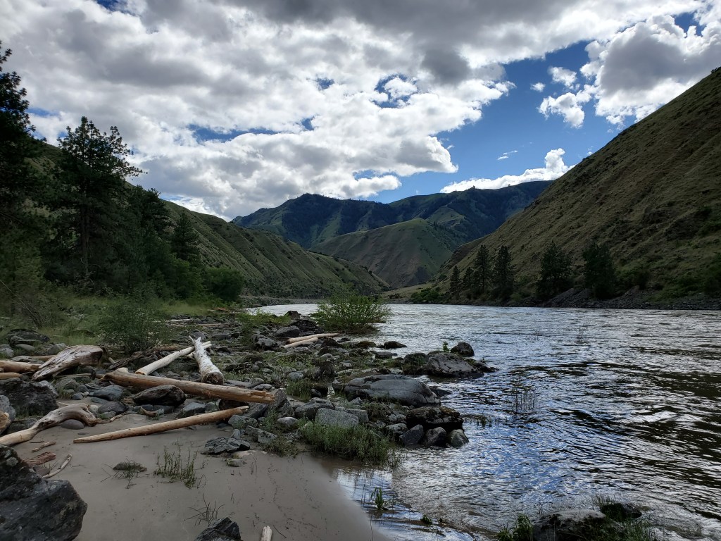
We spotted a pullout on the side of the road next to the Salmon river that happened to feature a random porta potty lifted up on a small platform. That patch of dirt seemed like a perfect place for a nap! Chris tried to offer to turn back and sleep in Riggins for the night, but I just couldn’t do it. I only napped for 10 or 15 minutes, and then forced myself to get going again. We’d at least make it to White Bird, we decided. So Chris took some pictures of the river while I dusted myself off, and we trudged on.

The last few miles to White Bird were sooooooo sloooooooow and it seemed like the town would never come. But it did! I obviously wasn’t in the best shape, so Chris assumed we’d be finding a place to sleep for the night. This was another eerie town, with giant grassy hills closing in on all sides. We only spotted one tiny motel, a convenience store, and a little bar. We stopped by the convenience store at 5:50pm, with 10 minutes to spare before they closed.
I shocked Chris by deciding I wanted to continue on. It was too early to stop, and I wanted to be tough even though I was exhausted. I asked him to survey the skies with me, to see if it looked like we might get caught in any weather if we headed up White Bird hill. It seemed safe, with the weather system trapped over a different mountain on the other side of the valley, so we decided to stock up and head out. We picked up gatorade, club crackers, a gigantic stack of turkey lunchmeat, some candy, a whole can of pringles, and more fruit. We sat on a wooden bench outside of the shop after they closed, and I briefly closed my eyes.

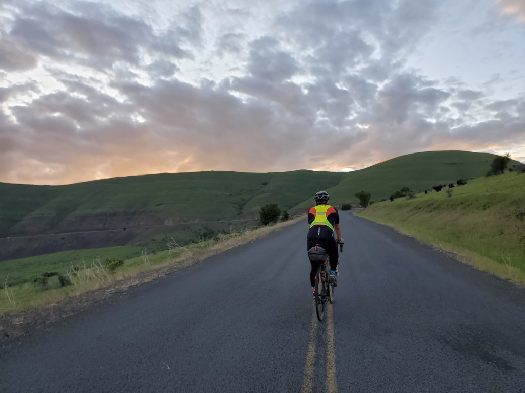
At some point this evening we returned to Pacific Time, but I’m not sure when. We started the climb out of town around 6:30 PM. As we left, the guys on the back patio of the bar across the street jokingly asked us if we wanted to abandon the ride to come join them instead. We didn’t see other signs of human activity as we headed out of town. We somewhat knew what we were in for this evening, because White Bird is a climb that previous racers have all blogged about. This is a small, nearly abandoned country road that switchbacks up directly outside of town. Most car traffic is diverted to the new highway that you can spot in the distance on a green grassy slope off to the left. White Bird is quite exposed, but we’d be spared since we were hitting it in the evening.
At first we couldn’t see much because the switchbacks are cut into the foothills surrounding town. I settled in and ended up listening to Aquarius on repeat, which was perfect for the moody sunset. Suddenly, we turned a corner and saw dozens of switchbacks heading up a mountain face – oh boy! This grade was just a little bit steeper than the other passes we’d tackled during the race. It would have been pretty doable under normal circumstances, but I was feeling weak and shaky and my knees started aching if I pushed too hard. We adjusted by hopping off our bikes to walk every 10 minutes or so. Time froze as we patiently tackled each switchback step by step, philosophizing about life and talking to the cows living on top of the mountain.
That was our life for the next 3-4 hours. Walking, resting, slow riding. Rinse and repeat. This ended up being one of my favorite moments from the whole race. Only 1 car passed us the whole time. We heard him coming for 5 minutes and watched him leave for 5 minutes, slowly winding up the switchbacks. We found out later that our East Coast and Central Time family stayed up worried about us, refreshing their computers constantly and confused as to how we were going SO SLOW. “It looks like they are walking”, they said in frantic messages to each other. They were right.
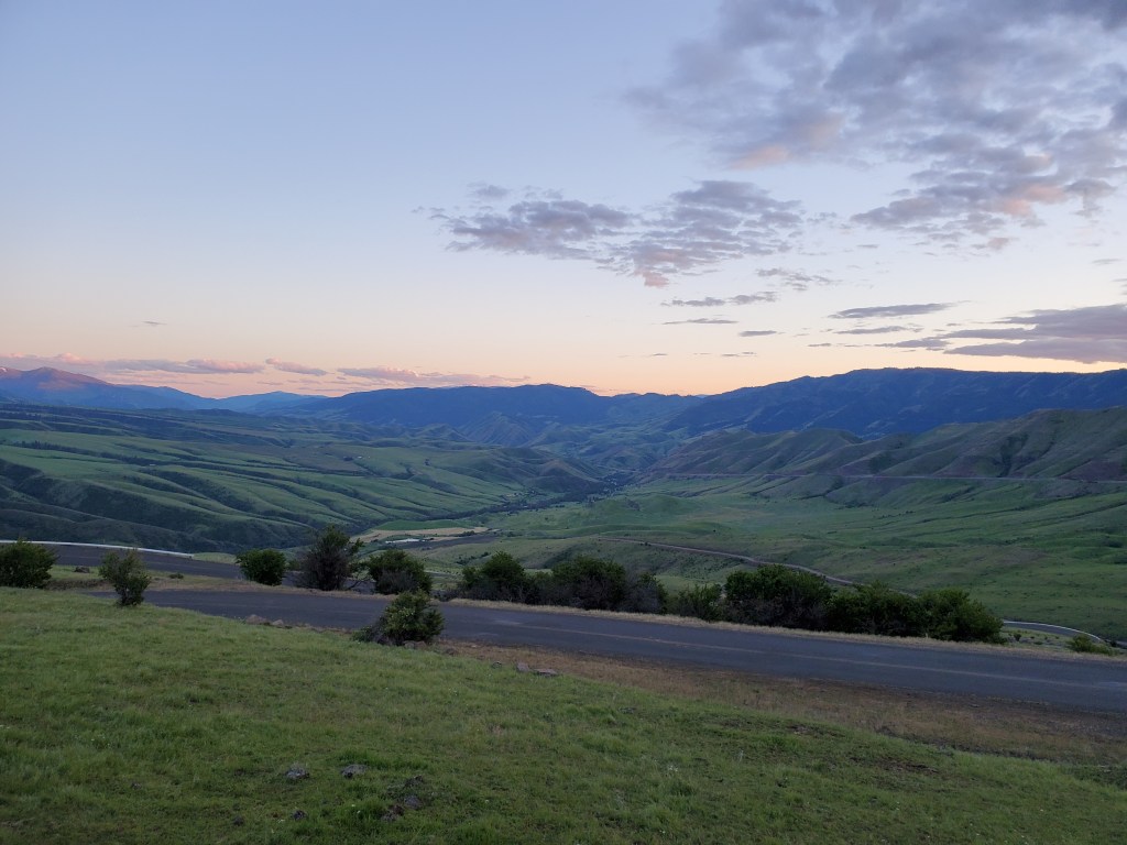
We reached the top right as the last sun left the sky. It started to get really cold, really fast. We got out ALL of the gear we owned to stay warm. And then the descent – oh my gosh what a blast! It would have been a nail biter, except for our amazing light setup and our rad disc brakes. I got ahead of Chris, because in addition to my dynamo light I turned on my two extra lights and rotated them to face left and right, giving me a wide swath of light by which to navigate the tight corners. The view coming off the mountain took my breath away: a faint pink sky with the lights of Grangeville glimmering in the distance. Suddenly my feet, shoulders, and hands ached and I was glad we were almost done.
After finishing the descent, we spent a couple miles on the highway. Fortunately, the Super 8 motel was one of the first buildings on the front side of town. We couldn’t figure out how to find the road into it though, so we cut through the grass and then noticed the bike tracks of somebody else who had recently done the same.
We headed in, grabbed our room keys, and watched somebody walk by with a pizza box. Chris asked the front desk about it, and they said it came from the Pizza Factory but they had just closed. We headed to our room to eat the leftover garbage in our bags instead. We also supplemented with doritos from the vending machine, using the only small bills we had left. I took a shower and accidentally dumped out most of our bottle of Dr. Bronner’s soap, which is all we had with us to use as body wash, shampoo, toothpaste, and laundry soap. We knew we’d only be traveling 110 miles the next day, so we set our alarms for 9am and quickly passed out.
——————–
Cambridge, Idaho to Grangeville, Idaho: 135 Miles
